 |
The Brazilian National Institute for Space Research (INPE) has placed a contract for a third year with DMC International Imaging Ltd., (DMCii) to acquire high-resolution satellite images of the entire 5 million square kilometres of the Amazon rainforest. Since 2004 INPE's programme to monitor deforestation has dramatically reduced the rate of logging from 27,000 sq.km. per year to about 10,000 sq.km. in 2007. In order to rapidly identify areas of cover change, DMCii is contracted to provide three repeat coverages in 2007 (June-July, July-August, September-October). In 2005, and again in 2006, DMC imaged the whole Amazon Basin in 6 weeks to provide Brazil with vital information to help monitor deforestation and combat illegal logging. DMC imagery is provided by the five-satellite international Disaster Monitoring Constellation (DMC). The DMC small satellites, built by Surrey Satellite Technology Ltd (SSTL), use wide area cameras to capture the high-resolution images. The latest satellite, built for China, was launched into the DMC on 27 October 2005. Two new DMC satellites will be launched in 2008 and a third in 2009. Speaking at the Royal Society in London, 25th October, Dr. Gilberto Cam�ra, Director General of INPE said, "The DMC data is an important affordable contribution to our assessment of deforestation of the Amazon rainforest. "The constellation is able to rapidly acquire and deliver high quality imagery so that we have up-to-date information to focus our efforts. It is our intention to develop a long term relationship with DMC" Paul Stephens, Marketing Director, DMCii said, "The increasing amount of DMC imagery required by INPE since 2005 demonstrates the value of rapid revisit imaging. When the new DMC satellites launch in 2008, these will add considerably to INPE's ability to monitor and combat changes in the rainforest and their consequences for both the local people and the global climate." The Brazilian National Institute for Space Research (INPE) INPE's mission is to make it possible for Brazilian society to benefit from new developments in space science and technology, mainly focusing on: 1. Increasing Brazil's autonomy in a number of strategic areas; 2. Providing the means for Brazilian industry to participate and become competitive in the space area; 3. Encouraging the development and dissemination of space technology; Deforestation rates in tropical Africa, Southeast Asia, and South America have remained constant or have increased over the past two decades, altering global carbon emissions and climate while elevating the need for frequent and accurate assessment of forest loss. In the Brazilian Amazon alone, where the growth of cattle ranching and cropland agriculture are the primary causes of forest clearing, about 20,000 square kilometres of forest are clear-cut and burned each year. INPE has developed a near or almost real time monitoring application for deforestation detection known as the Real Time Deforestation Monitoring System (DETER) system. High-resolution imagery is needed when estimating the total area of deforestation and when identifying small clearings. DMC International Imaging Ltd. (DMCii) is a UK supplier of remote sensing data products and services for international Earth Observation (EO) markets. DMCii supplies programmed and archived optical satellite imagery provided by the multi-satellite Disaster Monitoring Constellation (DMC). DMC data is now used in a wide variety of commercial and government applications including agriculture, forestry and environmental mapping. The small satellites of the DMC provide daily revisit in combination with an unmatched 600km imaging swath width at 32 metre ground sample distance (GSD) for frequent broad area coverage. DMC data products are calibrated and processed to a variety of levels according to customer requirements. Two new satellites with 22metre GSD will be launched in October 2008 for the UK and a new DMC member, Spain. In 2009 SSTL will launch a second satellite into the DMC for Nigeria which, in addition to the standard 32 metre imager, will carry very high resolution 2.5 metre panchromatic and 5 metre multispectral imagers. Related Links DMC International Imaging Ltd. (DMCii) Surrey Satellite Technology Ltd Earth Observation News - Suppiliers, Technology and Application
 Moffett Field CA (SPX) Oct 24, 2007
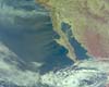
With a click of the mouse button, the public can see NASA views from space, including some at Google Earth, of Southern California's raging wildfires and the ferocious Santa Ana winds that are driving them. |
|
| The content herein, unless otherwise known to be public domain, are Copyright Space.TV Corporation. AFP and UPI Wire Stories are copyright Agence France-Presse and United Press International. ESA Portal Reports are copyright European Space Agency. All NASA sourced material is public domain. Additional copyrights may apply in whole or part to other bona fide parties. Advertising does not imply endorsement, agreement or approval of any opinions, statements or information provided by Space.TV Corp on any Web page published or hosted by Space.TV Corp. Privacy Statement |

