|
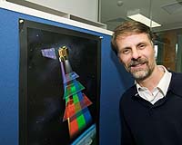
Canberra, Australia (SPX) Feb 25, 2008 A space-based international Earth observation network to detect and monitor natural disasters in the Asia-Pacific region has been formed with a substantial contribution from Australian science. Called Sentinel Asia, the network of information-delivery websites has its roots in the Australian bushfire tracking system, Sentinel Hotspots, which was developed in 2002 by CSIRO, Geoscience Australia and the Australian Defence Imagery and Geospatial Organisation. "This will be a critical information delivery system on wildfires, flooding, drought, and landslides in our region, where those events can be seen by Earth observing satellites in real time," says the coordinator of Australia's input, senior CSIRO Marine and Atmospheric Research scientist Dr Alex Held. "Australia has had a pivotal, strategic role in developing the system which has the potential to benefit billions of people in our region by assisting authorities in a recovery response," he said. "The concept of Sentinel Asia is to provide online information from Earth observation satellites in 'near real-time' through a network of webGIS services such as the Australian Sentinel Hotspots system." Initially supported by the Japanese Government through the Japan Aerospace Exploration Agency (JAXA), Sentinel Asia aims to show the value of Earth observation data for disaster management in the region. The system has been activated 10 times by seven countries including Australia in the last 12 months, mostly in response to earthquakes and floods. Planned improvements include further nodes in other countries, use of high bandwidth communications satellites to provide information more quickly, and access to a wider range of Earth observation satellites. Dr Held said many of the causes and impacts of natural disasters, including droughts, are observable, often in real-time, from space by orbiting or geostationary Earth observing systems. "When efficiently combined with modern information-distribution methods, this data can be sent rapidly to affected communities and local emergency agencies in some cases as early-warning before the disaster occurs, or as post-disaster maps, to assist in recovery operations," he said. The system largely uses free-to-air satellite imagery produced by Earth-observing satellites operated by the US, Europe, Japan, India and, in the future, other countries in Australasia which are planning satellite launches. Related Links CSIRO Bringing Order To A World Of Disasters A world of storm and tempest When the Earth Quakes
 Manila (AFP) Feb 23, 2008
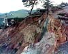
The death toll from flashfloods and landslides in the central and southern Philippines, after a week of heavy rains, rose to 26 with nine more still missing, the civil defence office said Saturday. |
|
| The content herein, unless otherwise known to be public domain, are Copyright Space.TV Corporation. AFP and UPI Wire Stories are copyright Agence France-Presse and United Press International. ESA Portal Reports are copyright European Space Agency. All NASA sourced material is public domain. Additional copyrights may apply in whole or part to other bona fide parties. Advertising does not imply endorsement, agreement or approval of any opinions, statements or information provided by Space.TV Corp on any Web page published or hosted by Space.TV Corp. Privacy Statement |