|
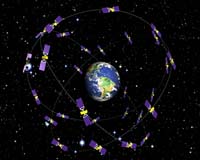
Washington DC (SPX) Jan 07, 2008 NOAA will lead an international effort to pinpoint the locations of more than 40 global positioning satellites in Earth orbit, which is vital to ensuring the accuracy of GPS data that millions worldwide rely upon every day for safe navigation and commerce. NOAA personnel will compile and analyze satellite orbit data from 10 analysis centers worldwide to ensure the accuracy of GPS information. For the next four years NOAA's National Geodetic Survey will serve as the Analysis Center Coordinator for the International Global Navigation Satellite Systems Service, a voluntary federation of more than 200 organizations that provide continuous global satellite-tracking data. "For GPS receivers to provide accurate information, the precise location of positioning satellites as they orbit the Earth must first be determined," said David Zilkoski, director of NOAA's National Geodetic Survey. "NOAA looks forward to leading this international partnership to produce the highest quality satellite position data possible." The Global Navigation Satellite Systems, which include the U.S.-based Global Positioning System, the Russian GLONASS system, and the upcoming European Galileo system, are used for accurately determining the geographic position of any point on Earth. A GPS receiver calculates its position by measuring the time it takes a signal to travel from the satellite to the receiver. Because the signal travels at a known rate and the time is precisely measured using an atomic clock, the receiver can calculate its distance from the satellite. By repeating this process from four or more GPS satellites whose orbits are precisely known, the GPS receiver can determine its position. Related Links NOAA GPS Applications, Technology and Suppliers
 Krasnoyarsk (RIA Novosti) Dec 28, 2007
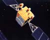
The three Glonass-M navigation satellites that Russia launched on Tuesday will be operational for seven years, a design and production bureau spokesman said on Wednesday. The three satellites were launched from the Baikonur space center in Kazakhstan on board an improved Proton-M carrier rocket to join the existing satellite constellation, which comprises 15 operational satellites. |
|
| The content herein, unless otherwise known to be public domain, are Copyright Space.TV Corporation. AFP and UPI Wire Stories are copyright Agence France-Presse and United Press International. ESA Portal Reports are copyright European Space Agency. All NASA sourced material is public domain. Additional copyrights may apply in whole or part to other bona fide parties. Advertising does not imply endorsement, agreement or approval of any opinions, statements or information provided by Space.TV Corp on any Web page published or hosted by Space.TV Corp. Privacy Statement |