| . |  |
. |
|
|
. |
by Staff Writers Leeds UK (SPX) Jun 06, 2011
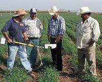
A PhD student at the University of Leeds has developed a fast, accurate and inexpensive method of creating detailed vegetation community maps over very large areas, by coupling aerial photographs with data from maps. Working in partnership with the Yorkshire Dales National Park Authority, Ute Bradter from Leeds' Faculty of Biological Sciences, has collated existing data (such as soil type, altitude, slope and aspect) and using a sophisticated statistical model, predicted the distribution of plant communities at a high resolution in the Yorkshire Dales, over 1600 km2. Her results, published June 1 in the British Ecological Society's Journal of Applied Ecology showed an accuracy of up to 92 per cent, comparable with the traditional mapping method of on-site surveys conducted by trained ecologists. Detailed and high resolution vegetation maps noting species distribution are a crucial resource for land management, conservation planning, environmental monitoring and research. But manual mapping is a slow and expensive process, and faster, reliable methods are much needed. Automatic mapping using aerial or satellite photography has been attempted, but until now, achieving reliable degrees of accuracy has proven difficult. "What Ute has achieved is remarkable," says her supervisor and co-author Professor Tim Benton. "To put it into perspective, it would take sixteen years of day-in, day-out sampling for one experienced ecologist to replicate this particular mapping exercise by hand." Vegetation in an area is classified into different communities depending on the range of species and their abundance. Communities can be described in detail, for example there are 22 vegetation communities on British heaths alone. The Leeds research combined information and datasets from a range of readily available sources, such as soil maps, standard ordnance survey maps and aerial photography. The predictions were categorised into 24 National Vegetation Classification groups (plus an extra catch-all category of "wood") to a 5m resolution. "The statistical model is highly accurate because of the diverse range of information we used," says Bradter. "The high resolution aerial photography gave us added colour and texture - for example to differentiate wooded areas from other areas - but we incorporated additional physical information into the model, such as topographical measurements of slopes and elevation, and information from different spatial scales." "Our approach shows that even for relatively complex vegetation classifications it is possible to produce accurate maps over hundreds of square kilometres. We're particularly pleased given that some vegetation communities are difficult to distinguish even using trained field workers," she adds. If further research confirms that the method performs as well in other environments, such as lowland areas, Bradter is confident that it could be used to accurately assess the conservation value of land in other regions and countries where similar datasets are available. Co-author and Senior Wildlife Conservation Officer at YDNPA, Dr Tim Thom, says: "This method also has the potential to be used for a wide range of other environmental purposes, such as identifying rare habitat, or where drainage ditches are grown over and so pose a flood risk, or where erosion-risk is high in areas of bare peat. "What's most exciting is that if we can map the plants accurately, we can also make a better guess what animals live there too, so we could also remotely monitor biodiversity across the farmed habitat or predict the potential value of setting aside pockets of land for conservation as part of agri-environmental schemes."
|
. |
|
| The content herein, unless otherwise known to be public domain, are Copyright 1995-2011 - Space Media Network. AFP and UPI Wire Stories are copyright Agence France-Presse and United Press International. ESA Portal Reports are copyright European Space Agency. All NASA sourced material is public domain. Additional copyrights may apply in whole or part to other bona fide parties. Advertising does not imply endorsement,agreement or approval of any opinions, statements or information provided by Space Media Network on any Web page published or hosted by Space Media Network. Privacy Statement |

 del.icio.us
 Digg
Digg Reddit
 Google