 |
Huntsville AL (SPX) May 17, 2011 The Short-term Prediction Research and Transition, or SPoRT, team has used satellite data from the North Alabama region to identify tornado damage from the April 27th super storm outbreak. NASA's Terra satellite, part of the Earth Observing System of satellites, captured images of the damage path. An instrument aboard Terra called the Advanced Spaceborne Thermal Emission and Reflection Radiometer, or ASTER, was used to discern vegetation contrasts over the region. "This is the first time ASTER data has been applied to such a massive outbreak of storms," said Gary Jedlovec, atmospheric scientist at Marshall Space Flight Center. "The usefulness of satellite information in providing improved accuracy along with damage assessment in severe weather events continues to evolve." The tornado track signature observed by ASTER is seen as a disruption in the vegetation or other reflective surfaces over a region caused by tornado winds. Uprooted trees quickly stop the process of photosynthesis and change color - this is easily detected by satellite. However, detecting damage in areas outside of heavy forestland is challenging. In Madison and Limestone counties much of the area scarred by the tornadoes are agricultural in nature. Fields are either pasture land or row crops - therefore the effect of tornado winds is minimal and the mark on satellite imagery is suppressed. While this indicates a limitation to the use of this particular image analysis for tornado track detection over primarily agricultural land use, the SPoRT team is exploring the use of temperature channels from ASTER to better identify damage marks on Earth's surface. Terra/ASTER is a joint activity between NASA's Science Mission Directorate Earth Science Division and Japan's Ministry of Economy, Trade and Industry. Terra is one of 14 NASA satellites that look at the Earth to study and understand changes in the Earth system and provide societal benefits. The NASA image created by the Short-term Prediction and Research Transition or SPoRT project at the Marshall Space Flight Center in Huntsville, using data provided courtesy of NASA Goddard Space Flight Center, the Land Processes Distributed Active Archive Center, Japan's Earth Remote Sensing Data Analysis Center, the Ministry of Economy, Trade and Industry, along with the Japan Research Observation System Organization.
Share This Article With Planet Earth
Related Links NASA Terra satellite Earth Observation News - Suppiliers, Technology and Application
 ESA's water mission keeps tabs on dry spring soils
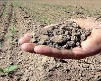
Paris, France (ESA) May 13, 2011 Western Europe's exceptionally dry spring is clear to see in maps generated using data from SMOS. While these maps offer an interesting view of the stark difference in soil moisture compared to a year ago, the data are also important for agricultural and hydrological applications. ESA's Soil Moisture and Ocean Salinity (SMOS) mission has been orbiting Earth for 18 months now, making global ... read more |
|
| The content herein, unless otherwise known to be public domain, are Copyright 1995-2010 - SpaceDaily. AFP and UPI Wire Stories are copyright Agence France-Presse and United Press International. ESA Portal Reports are copyright European Space Agency. All NASA sourced material is public domain. Additional copyrights may apply in whole or part to other bona fide parties. Advertising does not imply endorsement,agreement or approval of any opinions, statements or information provided by SpaceDaily on any Web page published or hosted by SpaceDaily. Privacy Statement |


 del.icio.us
 Digg
Digg Reddit
 YahooMyWeb
 Google